Theme 3: Eco-DRR/Nature-based solution
The goal is to establish an optimal design method for gray infrastructure that takes into account the time variability of green infrastructure. The three goals of this research group are as follows.
a) Literature review and field survey will be conducted for understanding characteristics and distributions of mangrove (Theme 3) and sandy beach (Theme 1).
b) Wave overtopping estimation chart of coastal barriers with green infrastructure from hydraulic and numerical experiments will be developed.
c) The draft of guideline to design optimal green-gray combined infrastructure will be compiled (by considering the hazard scenario from theme 2).
In hydraulic experiment and model development, we will collaborate with the Indonesian side to transfer the technology so that it can be independently evaluated in other regions.
テーマ3
グリーンインフラによる防災効果の推定方法の確立
グリーンインフラの時間変化を考慮したグレーインフラの最適設計法の確立を目標とします。本研究グループの目標は以下3つです。
- a)モデル地域の砂浜地形の特徴を把握し海浜変形予測モデルの構築および現地調査結果をもとにしたマングローブ・海岸林の成長曲線、森林拡大率の定量化
- b)これらのグリーンインフラの調査結果をもとにした高波・津波の低減効果に関する水理模型実験および数値シミュレーション、およびグリーンインフラを考慮したグレーインフラ設計のためのこれまでになかった新しい越波・浸水算定チャートの作成
- c)この算定チャートとa), b)の結果とを組み合わせ、グリーンインフラの時空間変化を考慮したグレーインフラ(堤防等)の最適設計法を構築し、ガイドラインもしくはマニュアルの作成
水理実験およびモデル開発においては、インドネシア側と共同し、他地域でも自立的に評価可能なように技術移転を図ります。
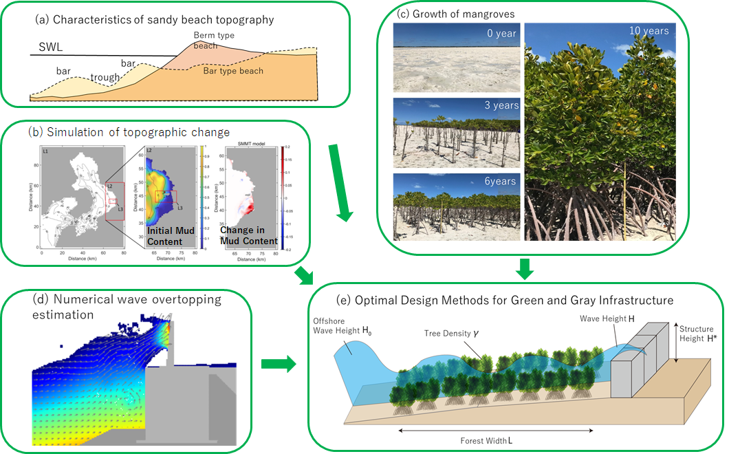
グループ3の目標概念図:a)インドネシアの砂浜地形特性の定量化,b)海浜変形シミュレーション,c)マングローブ・海岸林の特性の定量化,d)高度な数値計算による越波推定,e)グリーン・グレーインフラの最適設計